I'm forwarding this interesting information from "Dr. Darrel"
>>>>>>>>>>>>>>>>>>>>>>>>>>>>>>>>>>>
I'm not sure if I've ever had a logon to the funston website, but I thought this would be interesting to the group.
Over the years, I've never heard an explanation of where the southerly component comes from in the shear. The lower level southerly turbulent air forms in the setting of a strong north wind.
So I asked Professor John Monteverdi at San Francisco State University via an email having found him on the university website. He teaches meteorology in the Department of Geosciences. Here is his answer:
Darrel,
Well, I have a guess. But, the other explanations I've seen about "intersecting wind layers" make no meteorological sense.
There are two existing one that make sense.
First, let's separate the layer of air in contact with the ground and subject to friction (called the boundary layer) from the layer above it (usually 1 km and above).
During the summer, it is common for meteorolgical conditions to favor something called a "southerly surge" immediately adjacent to the coast. This is a sudden reversal of the low level northwesterly winds in the boundary layer, to southerly or southwesterly, and works its way south to north along the coast. In that case, you'd get strong southerly winds surmounted by northwesterly winds or northerly winds aloft (above 1 km) and off the coast. You can see an example of a southerly surge here.
http://www.weather.nps.navy.mil/%7Epsgu ... movie.html
In other circumstances, strong northwesterly boundary layer winds interacting with topography, say Point Reyes, will stimulate a cyclonic eddy in the boundary layer near or downstream of Point Reyes. This will induce southerly or southwesterly flow in the boundary layer.
http://tornado.sfsu.edu/geosciences/Cal ... sEddy.jpeg
In either case, when strong southwesterly winds encounter coastal topography under a temperature inversion, you are likely to get a standing wave (vertical wave, as viewed from the side) generated by topography, in the portion of the flow that is southwesterly, and impinging the coastal hills.
Hope that helps.
John
His explanation matches my own experience with the shear perfectly. It will take some time to understand all that is written about the "southerly surge," but I'm indebted to him for opening my eyes to the descriptions of this phenomenon. I think that meteorologist's interest in predicting fog may be useful in predicting the shear because they must account for the southerly surge..
Darrel Robbins
(Swift)
Southerly Surge and the Funston Shear
14 posts
• Page 1 of 1
-

Steve Rodrigues - Site Admin
- Posts: 723
- Joined: Mon May 24, 2004 10:57 pm
- Location: Brisbane, California
Predictions
I need a bit of time to absorb this. That being said, one standing question I've had for a while now is "can a shear at FF be predicted?"
The answer could be "no", or it could be "yes, if we only had <insert>". I don't know if it would help, but we could get the gear together to create a RASP map (Dr. Jack-based, local, high-resolution wind prediction) of SF.
So? I don't have Dr. Darrel's email, so I'd appreciate if Steve or someone else could forward.
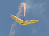
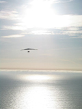
Now, the one thing about the photos above is that they all appear to place the clouds offshore. There are a few pics of what we call "shears" here - http://ridgedancer.sfbapa.org/content/view/53/29/ and http://www.geoffreyrutledge.com/Album/F ... photo9.jpg (my favorite). In all cases the cloud layer is, roughly speaking, over the land while the ocean is clear. Is this explained by the theories in Dr. Darrel's posting?
Daniel
-

Daniel Pifko - Site Admin
- Posts: 249
- Joined: Tue Jan 13, 2004 5:23 pm
History of Funston Shear
Does anyone know the history of how the Funston Shear was identified?
It would be interesting to know who was the first, when it was, and what kind of glider they were flying.
-ErikMW
It would be interesting to know who was the first, when it was, and what kind of glider they were flying.
-ErikMW
ErikMW
- ErikMoldWarrior
- Posts: 4
- Joined: Fri Oct 24, 2008 9:12 am
Funston Shear Dating
It was before 1978 (When I started ).,
All I remember being told, at the time was be at the North End when the air was trashy at the South End and you had a chance of getting into the shear if you did not end up on the beach.
My first Funston shear took me to Pacifica Pier in a Seagull 10M.
All I remember being told, at the time was be at the North End when the air was trashy at the South End and you had a chance of getting into the shear if you did not end up on the beach.
My first Funston shear took me to Pacifica Pier in a Seagull 10M.
- Steve Urbach
- Posts: 43
- Joined: Sat Feb 07, 2004 9:22 am
- Location: Palo Alto
History of Funston Shear
Thanks.
First time I saw someone WAY up in the shear was 1980.
Couldn't believe my eyes.
Truly, an amazing phenomenon.
Always wondered who was the first to get caught up in the shear, and be faced with trying to figure out what the heck was going on.
I wonder if Wally up at Merlin remembers pilots early experiences with the shear?
-ErikMW
ErikMW
- ErikMoldWarrior
- Posts: 4
- Joined: Fri Oct 24, 2008 9:12 am
History of Funston Shear
Steve.
That's really going back aways.
Didn't Jan Case turn into "Jan Stewart"?
But yeah, Good call. I reckon Jan would know.
That's really going back aways.
Didn't Jan Case turn into "Jan Stewart"?
But yeah, Good call. I reckon Jan would know.
ErikMW
- ErikMoldWarrior
- Posts: 4
- Joined: Fri Oct 24, 2008 9:12 am
Might have :/
I went to her wedding (after a day af flying at Hull) when it turned from Case to Hankey.
I went to her wedding (after a day af flying at Hull) when it turned from Case to Hankey.
- Steve Urbach
- Posts: 43
- Joined: Sat Feb 07, 2004 9:22 am
- Location: Palo Alto
Funston Shear
The pilot to ask is Dave Chavez. He and his son pioneered the site. Dave either was the first or one of the firsts for most of the things we do at Funston.
- Dan Brown
- Posts: 88
- Joined: Fri Apr 01, 2005 2:01 pm
Sheer flying
Hey Steve, git that old 10 Meter out of storage and give it a whirl someday.  . I can remember the first sheer I flew in the late 70's. I was test flying a friends glider and it was real trashy, I got into a sheer for about 2 hours, the guy that let me fly his glider had to wait for me. We all had a good day. I told him his glider was ok to fly.
Tom
- cliffblack
- Posts: 103
- Joined: Mon May 30, 2005 11:54 am
- Location: palo alto
Hey there TJ
The 10M is long gone. Sold it when I got my 164 Stratus V boom.
I was trying to remember, I think the 10M was the glider I had for my first Shear when I flew to Pacifica Pier. I flew the Stratus V on my other Shear trip to the old A & W and landed down wind because I failed to notice the complete direction shift over the gravel pit. Nothing bent!
- Steve Urbach
- Posts: 43
- Joined: Sat Feb 07, 2004 9:22 am
- Location: Palo Alto
Skwirly Stratus V
Steve.
Did you by chance, get to fly a German bowsprit "Saphir"?
If so, how did it compare to the Stratus...skwirly-wise?
Thx.
Did you by chance, get to fly a German bowsprit "Saphir"?
If so, how did it compare to the Stratus...skwirly-wise?
Thx.
ErikMW
- ErikMoldWarrior
- Posts: 4
- Joined: Fri Oct 24, 2008 9:12 am
The only other Boom glider I flew was Chiefs Ant Eater <G>
I don't fly anymore, not health insurance eligible.
I don't fly anymore, not health insurance eligible.
- Steve Urbach
- Posts: 43
- Joined: Sat Feb 07, 2004 9:22 am
- Location: Palo Alto
zephyr
flew a zephyr for about 10 years. flew great. not good for towing, very yawy. they came out with a wing tip retrofit to help dampen the yawing. helped a little. bought it as a complete set with the Minimum power system. glider was extremely manueverable.
- paul donahue
- Posts: 8
- Joined: Tue May 01, 2007 4:21 pm
14 posts
• Page 1 of 1
Who is online
Users browsing this forum: No registered users and 9 guests
